


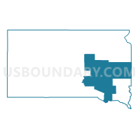
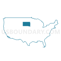
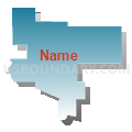
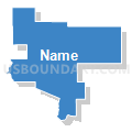
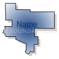
Jackrabbit Region PUMA, South Dakota
About
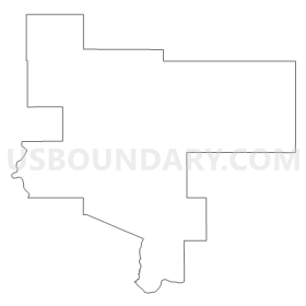
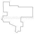
Outline
Summary
| Unique Area Identifier | 193971 |
| Name | Jackrabbit Region PUMA |
| State | South Dakota |
| Area (square miles) | 11,406.01 |
| Land Area (square miles) | 11,272.43 |
| Water Area (square miles) | 133.57 |
| % of Land Area | 98.83 |
| % of Water Area | 1.17 |
| Latitude of the Internal Point | 43.98807550 |
| Longtitude of the Internal Point | -98.04122440 |
Maps
Graphs
Select a template below for downloading or customizing gragh for Jackrabbit Region PUMA, South Dakota


Neighbors
Neighoring Public Use Microdata Area (by Name) Neighboring Public Use Microdata Area on the Map
- Brown, Lyon, Redwood, Chippewa, Yellow Medicine, Lac qui Parle & Lincoln Counties PUMA, MN
- Lakota Region PUMA, SD
- Northeast Nebraska PUMA, NE
- Northeast South Dakota PUMA, SD
- Southeast South Dakota (Outside Sioux Falls City) PUMA, SD
- Southwest Minnesota PUMA, MN
Top 10 Neighboring County (by Population) Neighboring County on the Map
- Minnehaha County, SD (169,468)
- Brookings County, SD (31,965)
- Yankton County, SD (22,438)
- Davison County, SD (19,504)
- Beadle County, SD (17,398)
- Lake County, SD (11,200)
- Rock County, MN (9,687)
- Pipestone County, MN (9,596)
- Charles Mix County, SD (9,129)
- Knox County, NE (8,701)
Top 10 Neighboring County Subdivision (by Population) Neighboring County Subdivision on the Map
- Brookings city, Brookings County, SD (22,056)
- Mitchell city, Davison County, SD (15,254)
- Huron city, Beadle County, SD (12,592)
- Madison city, Lake County, SD (6,474)
- West Yankton UT, Yankton County, SD (3,474)
- Chamberlain city, Brule County, SD (2,387)
- Flandreau city, Moody County, SD (2,341)
- Springfield city, Bon Homme County, SD (1,989)
- Volga city, Brookings County, SD (1,768)
- Crow Creek UT, Buffalo County, SD (1,736)
Top 10 Neighboring Place (by Population) Neighboring Place on the Map
- Brookings city, SD (22,056)
- Mitchell city, SD (15,254)
- Huron city, SD (12,592)
- Madison city, SD (6,474)
- Chamberlain city, SD (2,387)
- Flandreau city, SD (2,341)
- Springfield city, SD (1,989)
- Volga city, SD (1,768)
- Parkston city, SD (1,508)
- Miller city, SD (1,489)
Top 10 Neighboring Unified School District (by Population) Neighboring Unified School District on the Map
- Brookings School District 05-1, SD (25,450)
- Yankton School District 63-3, SD (20,134)
- Mitchell School District 17-2, SD (18,417)
- Huron School District 02-2, SD (15,123)
- Madison Central School District 39-2, SD (8,762)
- Pipestone Area School District, MN (7,718)
- Chamberlain School District 07-1, SD (6,044)
- Dell Rapids School District 49-3, SD (5,508)
- Tri-Valley School District 49-6, SD (5,024)
- Bon Homme School District 04-2, SD (4,791)
Top 10 Neighboring State Legislative District Lower Chamber (by Population) Neighboring State Legislative District Lower Chamber on the Map
- State House District 22A, MN (34,781)
- State House District 20A, MN (32,187)
- State House District 7, SD (24,910)
- State House District 25, SD (22,548)
- State House District 18, SD (22,438)
- State House District 20, SD (22,214)
- State House District 2, SD (21,657)
- State House District 22, SD (21,252)
- State House District 21, SD (21,057)
- State House District 8, SD (20,647)
Top 10 Neighboring State Legislative District Upper Chamber (by Population) Neighboring State Legislative District Upper Chamber on the Map
- State Senate District 22, MN (71,339)
- State Senate District 20, MN (66,816)
- State Senate District 40, NE (31,744)
- State Senate District 7, SD (24,910)
- State Senate District 25, SD (22,548)
- State Senate District 18, SD (22,438)
- State Senate District 20, SD (22,214)
- State Senate District 2, SD (21,657)
- State Senate District 22, SD (21,252)
- State Senate District 21, SD (21,057)
Top 10 Neighboring 111th Congressional District (by Population) Neighboring 111th Congressional District on the Map
- Congressional District (at Large), SD (814,180)
- Congressional District 1, MN (644,787)
- Congressional District 7, MN (625,512)
- Congressional District 3, NE (561,378)
Top 10 Neighboring Census Tract (by Population) Neighboring Census Tract on the Map
- Census Tract 9589, Brookings County, SD (7,389)
- Census Tract 9602, Lake County, SD (6,610)
- Census Tract 9588.02, Brookings County, SD (6,516)
- Census Tract 9628, Davison County, SD (6,111)
- Census Tract 9570, Beadle County, SD (5,628)
- Census Tract 9627, Davison County, SD (5,467)
- Census Tract 9629, Davison County, SD (5,007)
- Census Tract 9590, Brookings County, SD (4,985)
- Census Tract 9587, Brookings County, SD (4,965)
- Census Tract 101.01, Minnehaha County, SD (4,601)
Top 10 Neighboring 5-Digit ZIP Code Tabulation Area (by Population) Neighboring 5-Digit ZIP Code Tabulation Area on the Map
- 57006, SD (24,530)
- 57301, SD (18,375)
- 57350, SD (14,534)
- 57042, SD (8,415)
- 56164, MN (5,969)
- 57022, SD (4,996)
- 57380, SD (3,470)
- 57028, SD (3,448)
- 57469, SD (3,305)
- 57325, SD (3,054)